Foote Mineral History
As of August 20, 2026, this site is NOT REMEDIATED.
The site is 79 acres. It is not just the 12 acres commonly referred to as the "capped area."
"Remediated" has a specific legal definition under CERCLA, the federal statute that regulates Superfund sites. It requires that the stipulations set out in the site's Record of Decision ("ROD"), including specific metrics for contamination levels in groundwater, surface water, and soil, actually be met.1
Groundwater lithium levels at the site's most contaminated monitoring well (MW-22) have been measured as high as 22,200 µg/L. That is roughly 85 times the 260 µg/L cleanup goal set in the 2006 Record of Decision. EPA has since determined that goal was too weak and now applies a stricter 40 µg/L standard for residential exposure. Measured against that current standard, contamination is over 500 times the acceptable level.2
While steps have been taken to remediate the site, it has never achieved the groundwater contamination levels required by the Record of Decision. It remains on the Superfund National Priorities List to this day.3
In September 2024, EPA concluded it could not determine whether the site is protective of human health and the environment.4 EPA also revoked the site's "Sitewide Ready for Anticipated Use" (SWRAU) designation.5 SWRAU is not a remediation classification and does not indicate the site is clean. It only indicates whether the site can be used for its intended purpose.
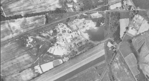
Historic photo of the site.
History
Foote Mineral operated at this site starting in the 1940s, mining and processing lithium and other minerals in large quarries on the property. According to the Tredyffrin Historical Society, lithium from this site contributed to the Manhattan Project.
The site was added to the federal Superfund National Priorities List in 1992 because of contamination in groundwater, surface water, and soil, including lithium, arsenic, and hexavalent chromium, the same chemical at the center of the Erin Brockovich case. More than 20 separate contaminants have been documented at the site.6
| Contaminant | Media | CAS # |
|---|---|---|
| 1,2-Dichloroethane | Soil, Groundwater | 107-06-2 |
| 1,2-Dichloroethene (cis/trans) | Soil | 540-59-0 |
| Antimony | Groundwater, Soil | 7440-36-0 |
| Arsenic | Groundwater, Soil | 7440-38-2 |
| Benzene | Soil, Groundwater | 71-43-2 |
| Bromine-containing inorganic compounds | Groundwater | E17001652 |
| Bromoform | Soil | 75-25-2 |
| Carbon tetrachloride | Groundwater, Soil | 56-23-5 |
| Chloroform | Soil, Groundwater | 67-66-3 |
| Chromium | Soil, Groundwater | 7440-47-3 |
| Cis-1,2-Dichloroethene | Groundwater | 156-59-2 |
| Ethylbenzene | Groundwater, Soil | 100-41-4 |
| Fluoride | Groundwater, Soil | 16984-48-8 |
| Iron | Soil | 7439-89-6 |
| Lithium | Soil, Groundwater | 7439-93-2 |
| Manganese | Soil | 7439-96-5 |
| Tetrachloroethene (PCE) | Groundwater, Soil | 127-18-4 |
| Thallium | Soil, Groundwater | 7440-28-0 |
| Trans-1,2-Dichloroethene | Groundwater | 156-60-5 |
| Trichloroethene (TCE) | Soil, Groundwater | 79-01-6 |
Source: EPA site contaminant records, CERCLIS site ID 0301103.7
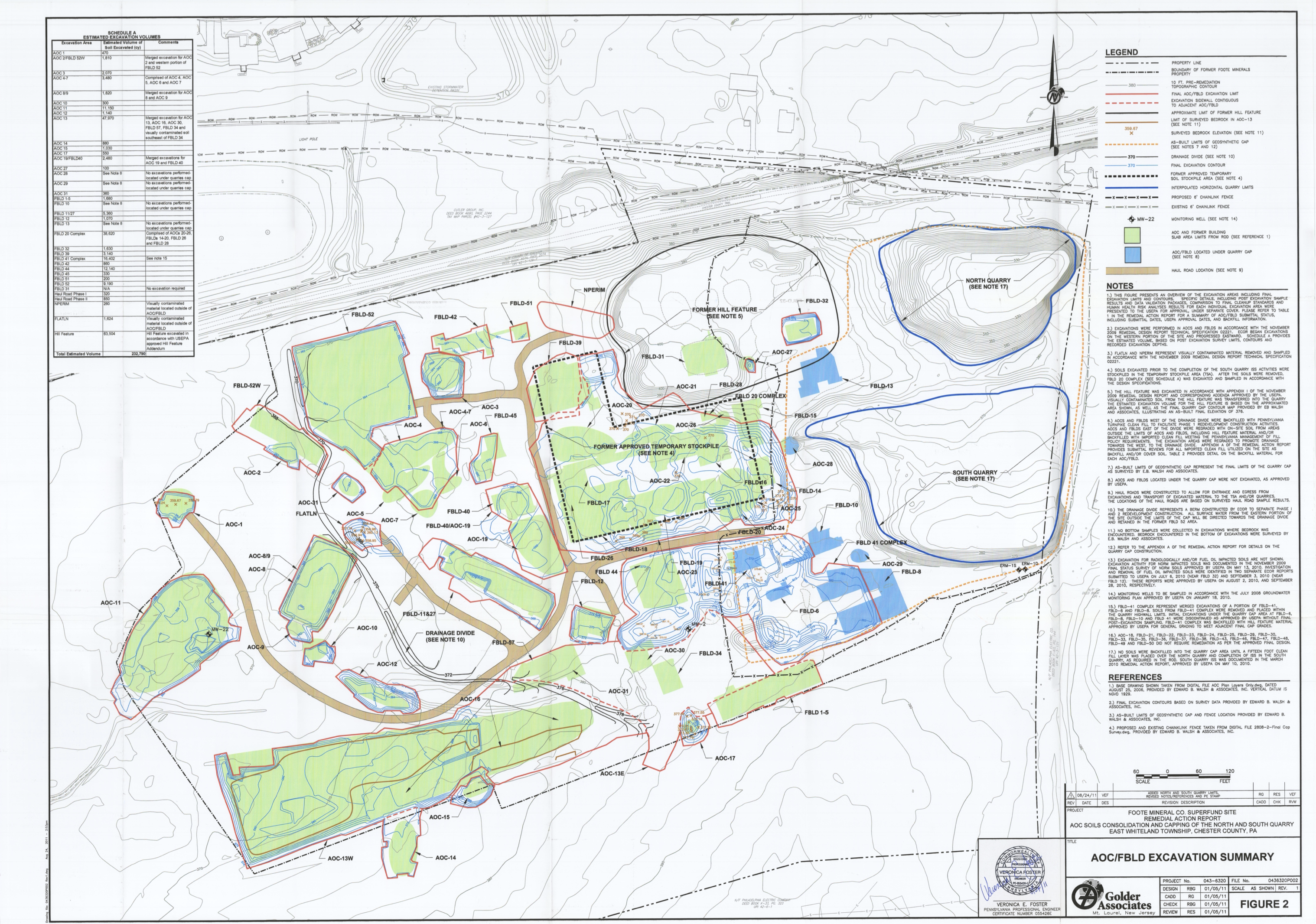
Areas of contamination at the site, per EPA documentation.
What "the cap" actually is
There is a common misunderstanding that only the 12-acre capped area is contaminated. That is false. The 2006 Record of Decision required that the worst contamination found across the site be excavated and consolidated into the capped areas.8
The cap is the area where the worst contaminated soil from across the property was placed. Contractors loaded the most heavily contaminated soils from other parts of the site into the former quarries, then covered them with clean fill. That is why the capped area appears as a mound roughly 12 feet high today.
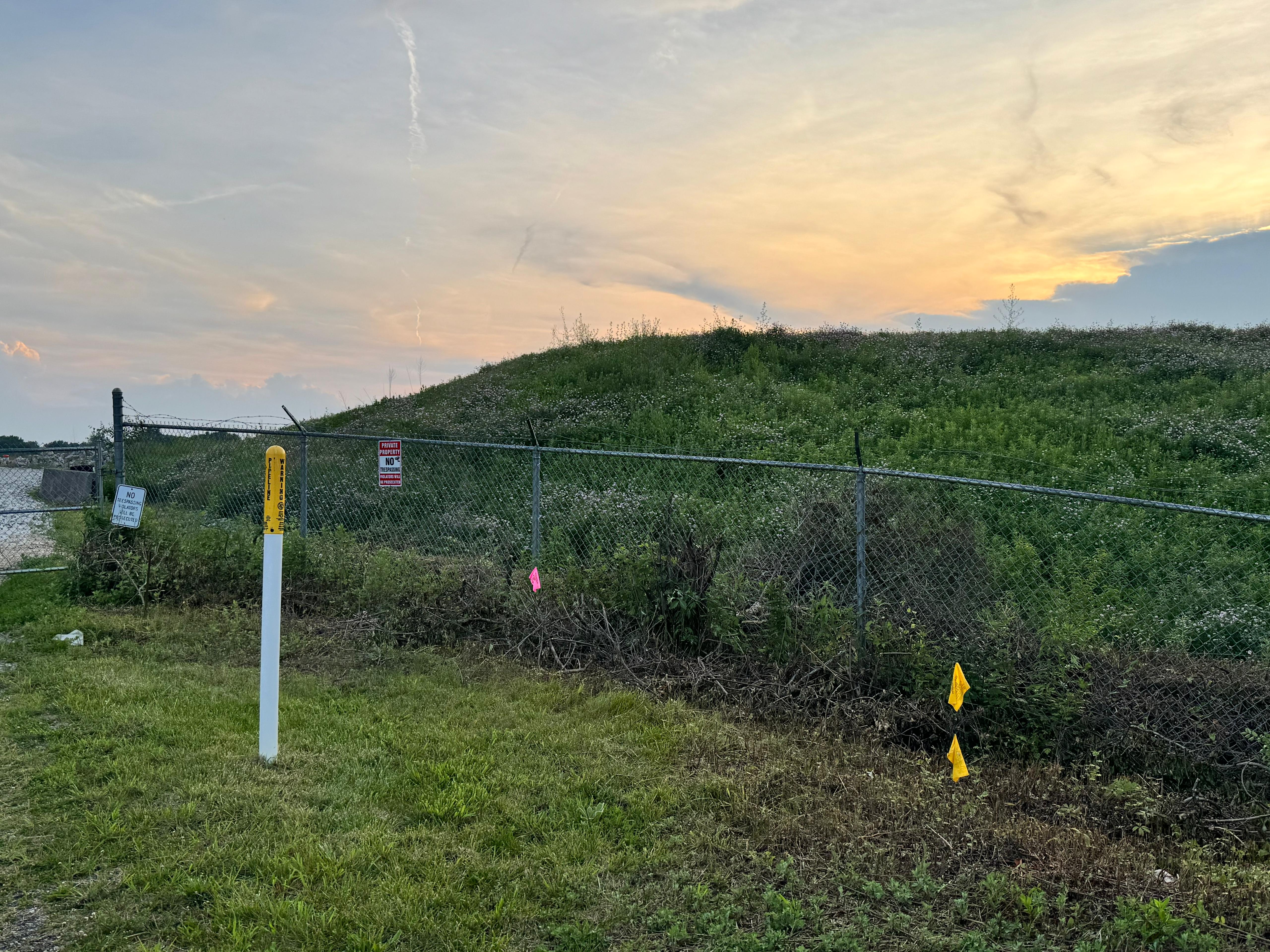
The capped area is indicated by the mound of dirt that rises approximately 12 feet in the air.
The site's 2006 Record of Decision documents dozens of separate contaminated areas outside the cap across the 79-acre property, including a former solvent burn pit, a former wash pond, former settling ponds, and soils beneath 52 demolished building foundations that were never fully characterized.9 Green Fig/Sentinel's data center is proposed for construction on uncapped portions of the property, which are missing the Institutional Controls required to restrict land use and still show areas of ongoing contamination.10 The developer has separately sealed monitoring well MW-22, the well showing some of the highest contamination levels on the site, and is building directly over it.11
- CERCLA § 101, 42 U.S.C.; 2006 Record of Decision.
- EPA Third Five-Year Review (Sept. 2024), Table D-2, Table J-1/J-2, MW-22 groundwater results.
- EPA CERCLIS / National Priorities List, 1992–present.
- EPA Third Five-Year Review, Sept. 2024, protectiveness determination.
- EPA Form 9100-4, SWRAU revocation, Sept. 16, 2024.
- EPA site contaminant records, CERCLIS site ID 0301103.
- EPA site contaminant records, CERCLIS site ID 0301103.
- 2006 Record of Decision, remedy description.
- 2006 Record of Decision; site issues inventory compiled from RI/FS and ROD documentation.
- EPA Third Five-Year Review, Sept. 2024, Land Use Changes section.
- EPA comfort letter to Sentinel, re: monitoring well relocation (ERM-5, ERM-6, MW-22).
- EPA Third Five-Year Review, Sept. 2024; Soils Management Plan, July 10, 2026, Section 3.4, Institutional Controls Review.